Thursday, January 24, 2013
Matthew Cusick Maps Out His Images
Matthew Cusick
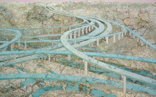
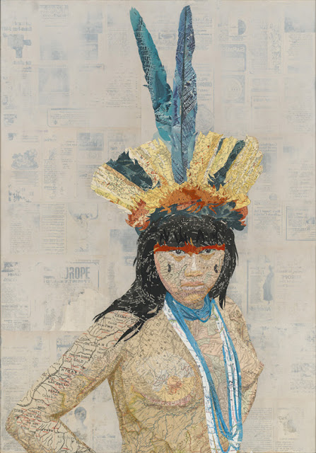
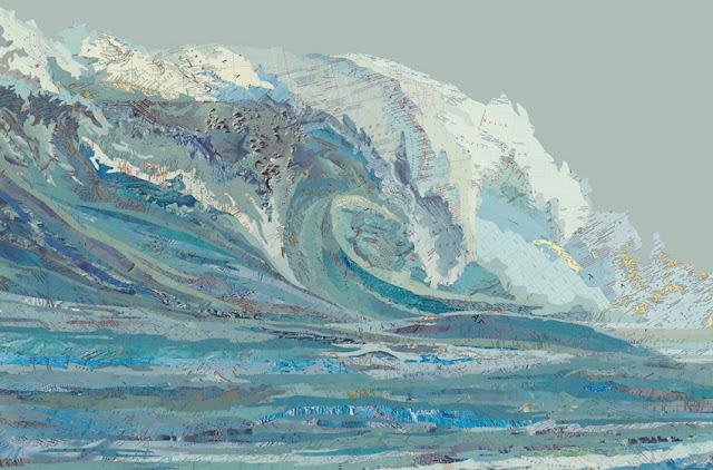
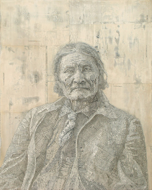
| Matt Cusick's extraordinary collages use maps to form the geometry and color palette of his work, with the elevation maps and other cartographic images blending into his images. |
In developing these collage pieces, Cusick slices segments of maps found in old textbooks, encyclopedias, and atlases and then forms the elements together into his compositions.
Most of Cusick's collages use the maps own colors to inform his palette, with the elevation maps and other cartographic images blending into his images.
From a distance, the collages almost look like vector based computer illustration, but viewing the pieces closer and over time reveals the subtlety of their construction.
Cusick explained how he got started using maps to More Magnificent Metropolis:
Frustrated with paint and brushes, I just started experimenting with some maps I had laying around the studio. I found that maps have all the properties of a brushstroke: nuance, density, line, movement, and color. Their palette is deliberate and symbolic, acting as a cognitive mechanism to help us internalize the external. And furthermore, since each map fragment is an index of a specific place and time, I could combine fragments from different maps and construct geographical timelines within my paintings.
Maps provided so much potential, so many layers. I put away my brushes and decided to see where the maps would take me. I think collage is a medium perfectly suited to the complexities of our time. It speaks to a society that is over-saturated with disparate visual information. It attempts to put order to the clutter and to make something permanent from the waste of the temporary. A collage is also a time capsule; it preserves the ephemera of the past. It reconstitutes things that have been discarded. A collage must rely on a kind of alchemy; it must combine ordinary elements into something extraordinary.
Cusick's provocative work below, Malvo features map locations and target imagery that made up part of the sniper's area of operation.
Malvo, 2011
Maps, sighting targets, ink, dye, on panel
40 x 30 inches
 |
| Many Rivers, 2009 Inlaid maps, acrylic, on panel 48 x 78 inches |
 |
Amazonia, 2012 Inlaid maps, travel magazines, on panel 33 x 23 inches |
Top Image
Mylan's Wave, 2012
Inlaid maps, acrylic on panel
24 x36 inches
SOURCES mattcusick.com, My Modern Metropolis
| By kree8tiv | Subscribe to kree8tiv |
Labels:
art,
collage,
color,
Matt Cusick,
painting
|
| |


No comments:
Post a Comment